Survey Studies
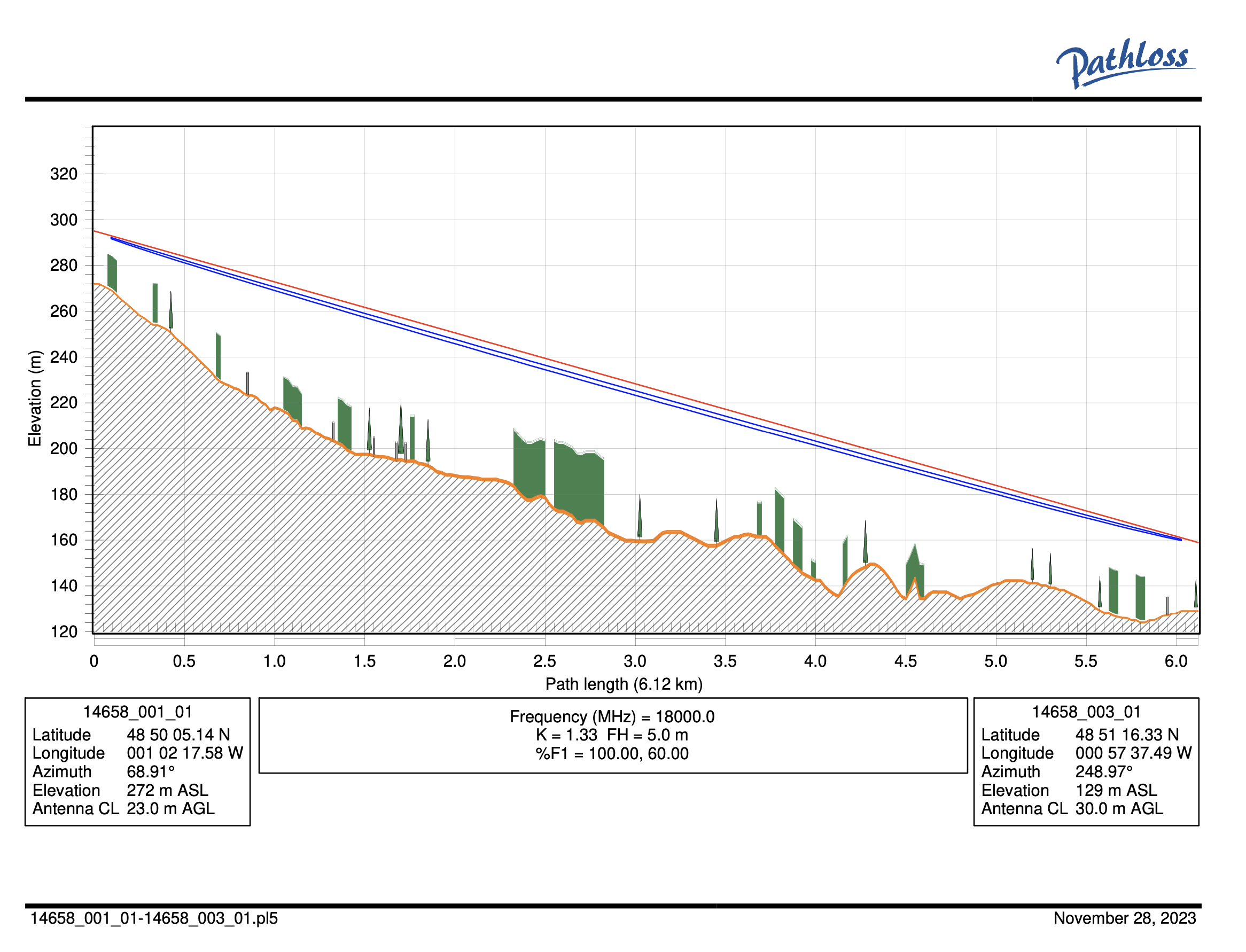
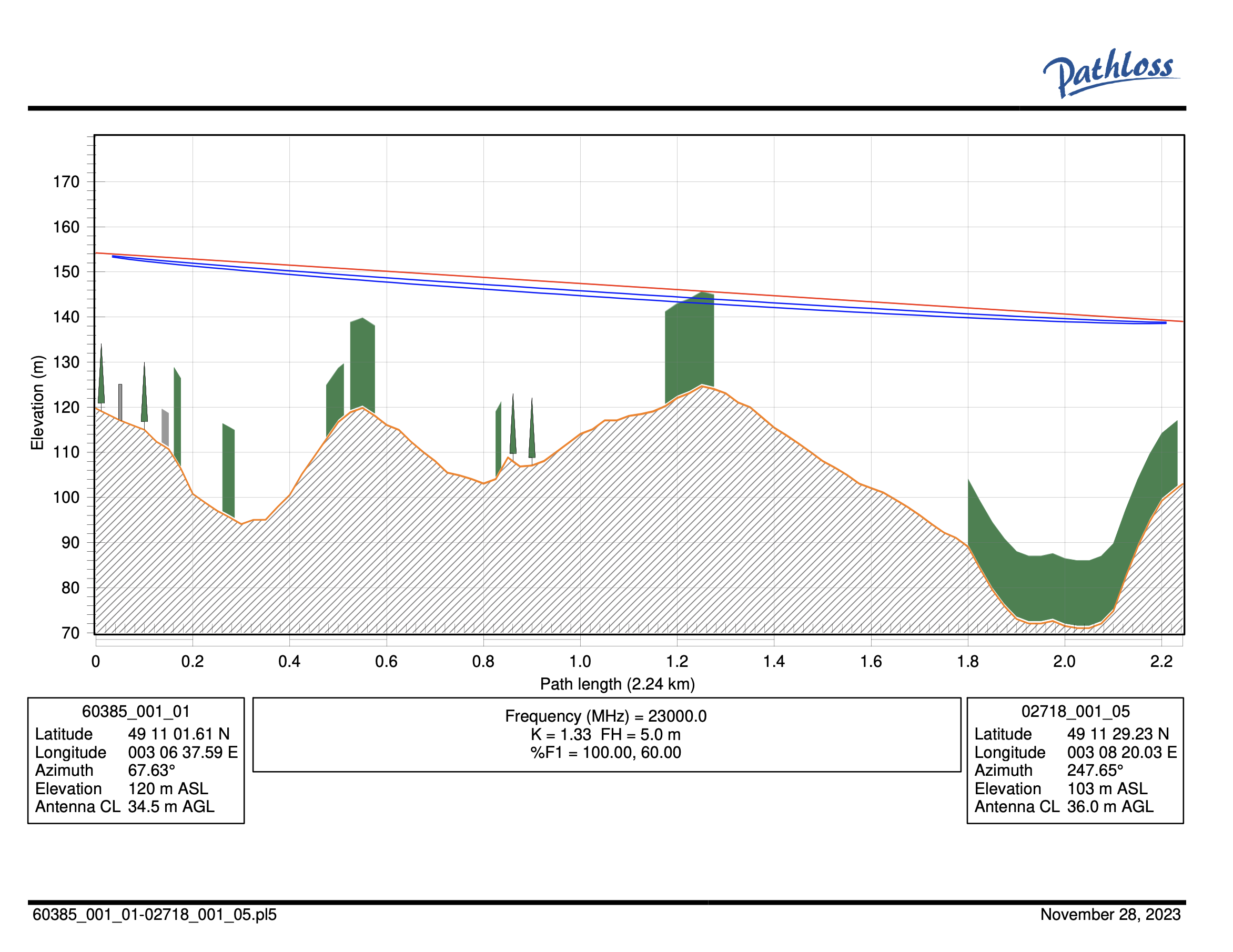
The Semadrones design office excels in the creation of comprehensive reports based on the field studies conducted by our drone pilots. These reports are based on a profile analysis using the most recent version of the Pathloss software.
Our expertise in bi-directional radio relay lines of sight is supported by a fleet of light drones, used to study links towards future pylons. Using highly precise GPS coordinates and altitude information, we can render precise field data and create a complete theoretical profile.
Our recommendations about the heights of additional radio relay installations are the result of painstaking work, and will guarantee optimal connectivity.
Our design office also handles the systematic verification of all of our input data, including GPS coordinates and minimum heights, ensuring coherence between the technical files provided (APD, DOE, CRVT, etc.).
We provide real-time tracking of our clients’ studies on our cloud platform, Semalos, where they can also download their reports. These reports are not time-limited, meaning our clients have easy access to all of their previous studies without having to wade through their email inboxes.